
Peru is known for its incredible hiking trails, but some areas, like the famed Andes Mountains around the city of Cusco, get all of the attention. And this is a HUGE oversight—the Cordillera Blanca mountain range, tucked away in northern Peru, boasts massive glaciers, more than 400 alpine lakes, and some of the tallest mountains in all of Peru. The Laguna 69 trail manages to combine ALL of those features (and SO much more natural beauty!) into one jawdropping day hike. So if you want to experience some of the best that the Andes Mountains have to offer, here’s everything you need to know about the Laguna 69 hike.

This post may contain affiliate links. If you make a purchase through them, we may receive a small commission, for which we are extremely grateful, at no extra cost to you.
About the Laguna 69 hike
- Length: 8.1 miles (13 km)
- Elevation gain: 2,696 feet (821.7 m)
- Difficulty: Challenging. The length and elevation gain would already make this on the harder side, but the fact that the trail starts at almost 13,000 feet (3962 m) over sea level definitely adds to the butt-kicking nature of this hike.
- Trail map

How to get to the Laguna 69 hike
The Laguna 69 hike is located here in Huascarán National Park in the Ancash region of northern Peru. Due to its unique glacial landscape and biodiversity, this national park is actually a UNESCO World Heritage Site and a Biosphere Reserve!
You can theoretically base yourself in a few different towns to explore Huascarán.
Huaraz
Most people that are exploring the Cordillera Blanca mountain range stay in the bustling mountain town of Huaraz, about two hours and 45 minutes south of the trailhead.
In my opinion, even though this is the farthest town from the national park, this is your best option, by far.
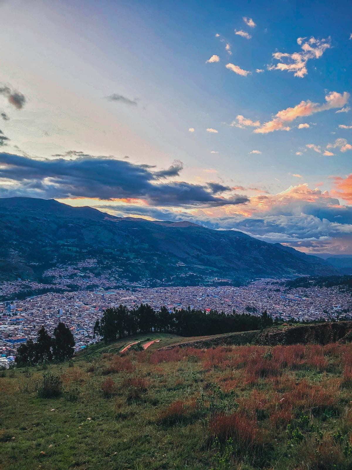
It’s one of the largest cities in Northern Peru and offers an excellent mix of tourist infrastructure, like hotels and restaurants, with authentic Peruvian life and culture. Most importantly, though, it’s SUPER easy to get to Laguna 69 from Huaraz, with seemingly countless tour operators lining its bustling streets; public transportation; and several taxi companies.
How to get to Huaraz
Getting to Huaraz is thankfully pretty easy.
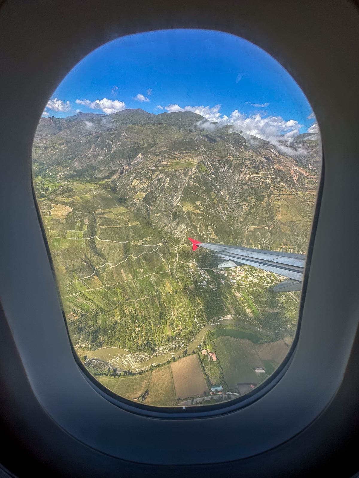
You can fly into its Comandante FAP Germán Arias Graziani Airport, which has regular direct flights from Lima, and then get a taxi into town (it should cost around 40-45 Peruvian soles). I’ve seen some odd information online that says that there’s no bookable flights to Huaraz’s airport—this isn’t true, as I’ve personally flown between Lima and Huaraz myself!
Alternatively, you can take a nine hour bus from Lima to Huaraz, like Justin and I did. It’s a loooong bus ride, but our go-to operator in Peru is Cruz del Sur—onboard bathrooms and super comfy seats!
Caraz
Alternatively, some travelers choose to stay in the small town of Caraz, about an hour and 40 minutes west of the trailhead.
To be honest, I don’t really see a huge advantage of staying in Caraz.
As far as I can tell, there’s no easy way to get from the town to Laguna 69. There aren’t any organized tours from Caraz, so you’d have to take a bus to the neighboring town of Yungay and then take a colectivo to the trailhead. This would cost about the same as what a tour from Huaraz would and generally takes a bit longer.

However, if you strongly prefer small town vibes to larger and more touristy cities, staying in Caraz may be a great option for you.
How to get to Caraz
To reach Caraz, you’ll need to first get to Huaraz and then take a colectivo or bus from the Huaraz bus station to the small town.
Yungay
Yungay is the smallest of the towns that you can base yourself in and is the closest to the trailhead, at about an hour and 15 minutes away.

There’s only a handful of hotels and restaurants here, but if you’re not going to stay in Huaraz, this would be my second choice, due to its proximity and the fact that you can directly catch a colectivo from the town to the trailhead itself.
How to get to Yungay
Like Caraz, the only way to reach Yungay is to take a bus to Huaraz and, from there, grab a colectivo to the town.
How to get to the Laguna 69 trailhead from Huaraz
Because the vast majority of travelers base themselves in Huaraz (and that’s where we’d recommend staying), we’re going to focus on how to get to Laguna 69 from Huaraz. There’s a few different ways that you can get there.
With a tour group
The easiest way, by far, to get to the Laguna 69 trailhead is by booking a tour.
If you’ll have a day or two in Huaraz ahead of your Laguna 69 hike, you’ll be able to book a tour for quite a bit cheaper in person from one of the many tour companies lining its streets (for usually around 50 Peruvian soles). However, if you’re short on time or just prefer to book your tours ahead of time (I’m a Nervous Nelly, too—I get it!), you can book a tour online, like this option or this private option.

From our experience, these tours are pretty bare bones and would more accurately be described as transportation to and from the trailhead.
They generally just include a VERY early morning pick up from your hotel, transportation to the trailhead (with a quick stop for a simple breakfast, which isn’t included), and then transportation back to downtown Huaraz. Although you have a “guide”, you hike on your own and the guide doesn’t really provide much information about the national park or the laguna itself.
By public transportation
If you’re on a super tight budget or strongly prefer to go without a group, you can alternatively take public transit.
You can grab a colectivo from Avenida Agustin Gamarra and Avenida Antonio Raymondi in downtown Huaraz to the town of Yungay and then, from there, grab another colectivo to Cebollapampa, where the trailhead is located.
Generally, taking public transit costs just a few soles less than if you book a tour in person and will take longer than being driven to the trailhead on a tour. So, unless you’re hellbent on not going on a tour, I’d suggest going that route instead.
With a private taxi
Alternatively, you can hire a taxi to take you from Huaraz to Laguna 69.
We shopped around for a taxi while we were here, as we preferred to get to the trailhead early to beat the crowds, and were quoted around 400 Peruvian soles for a roundtrip ride by several operators. This was a bit steep for our taste, but, if you have a large group that’s splitting up the cost and you prefer to have flexibility with your time on the trail, it might make sense.

How much does the Laguna 69 hike cost?
In addition to the cost of your transportation to Laguna 69, you also have to pay an entrance fee for Huascarán National Park. For foreigners, it’s 30 Peruvian soles for a one-day pass (cash only!).
If you plan on being in the park for more than three days (e.g., like if you also plan on doing the Santa Cruz trek), you should talk to your guide about purchasing a multi-day pass (that’s good for four to 30 days in the park) for 150 Peruvian soles.
What to expect along the Laguna 69 hike
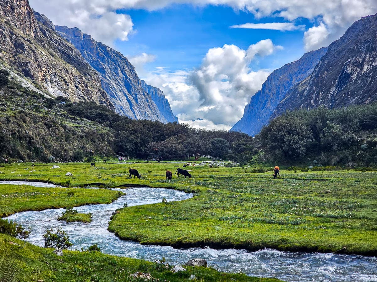
The trailhead starts at Cebollapampa, a beautiful green valley, carved by the Rio Ranrahirca, with happy cows munching on grass in seemingly every direction. This portion of the trail is blessedly flat, easing you into hiking at this high of an altitude.
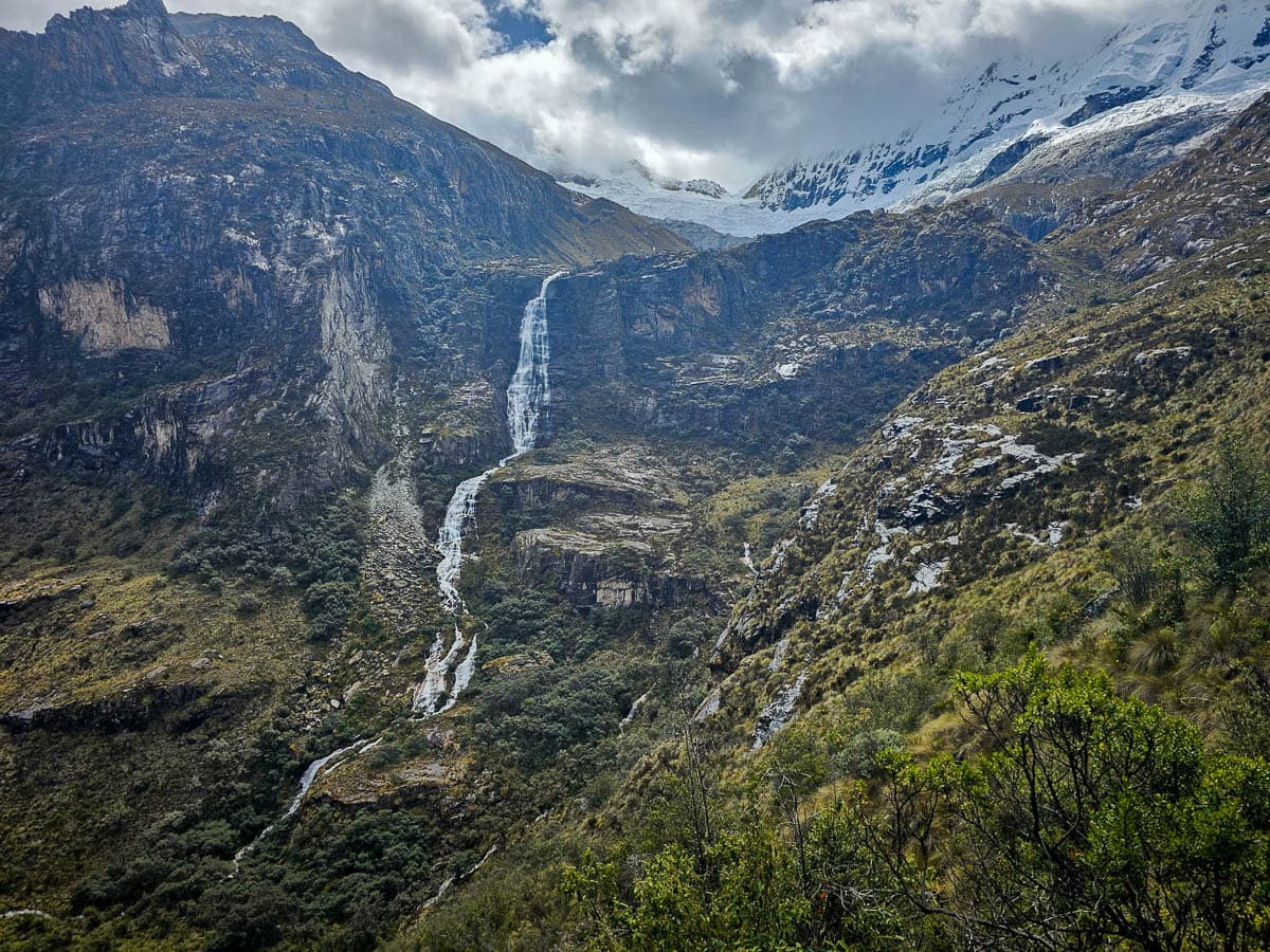
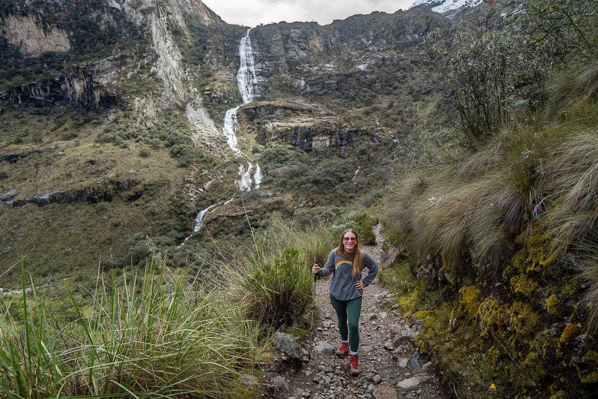
After this section, the trail gets noticeably steeper for the next mile or so (around 1.7 km), with steep switchbacks zig-zagging their way up the mountain. This is one of the most challenging parts of the trail, but, thankfully, you’ll be surrounded by absolutely STUNNING views to distract you—a towering waterfall, fed by the river, and the incredibly lush valley below.
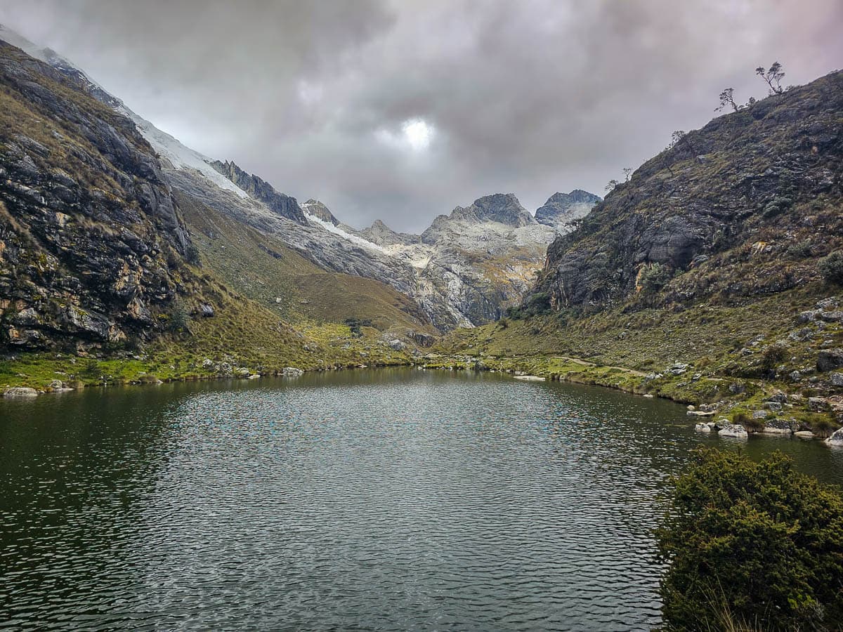
Around 2.8 miles (4.5 km) in, the trail becomes noticeably less steep, as you walk through wide meadows and eventually, pass the beautiful Laguna Esperanza, a small but picturesque lake that’s framed by rocky mountains.
After hiking for 3.7 miles (6 km), you’ll start making your final climb up to Laguna 69. This is the most challenging part of the trail, with an incline as steep as 39%, AND an altitude of close to—and even over—15,000 feet (4,572 m) above sea level. So take it nice and slow and just focus on putting one foot in front of the other—you got this!
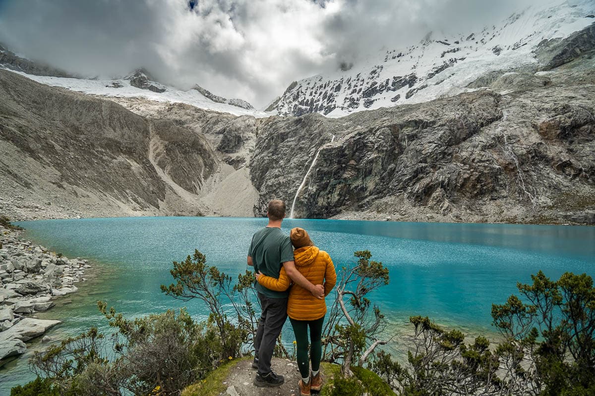
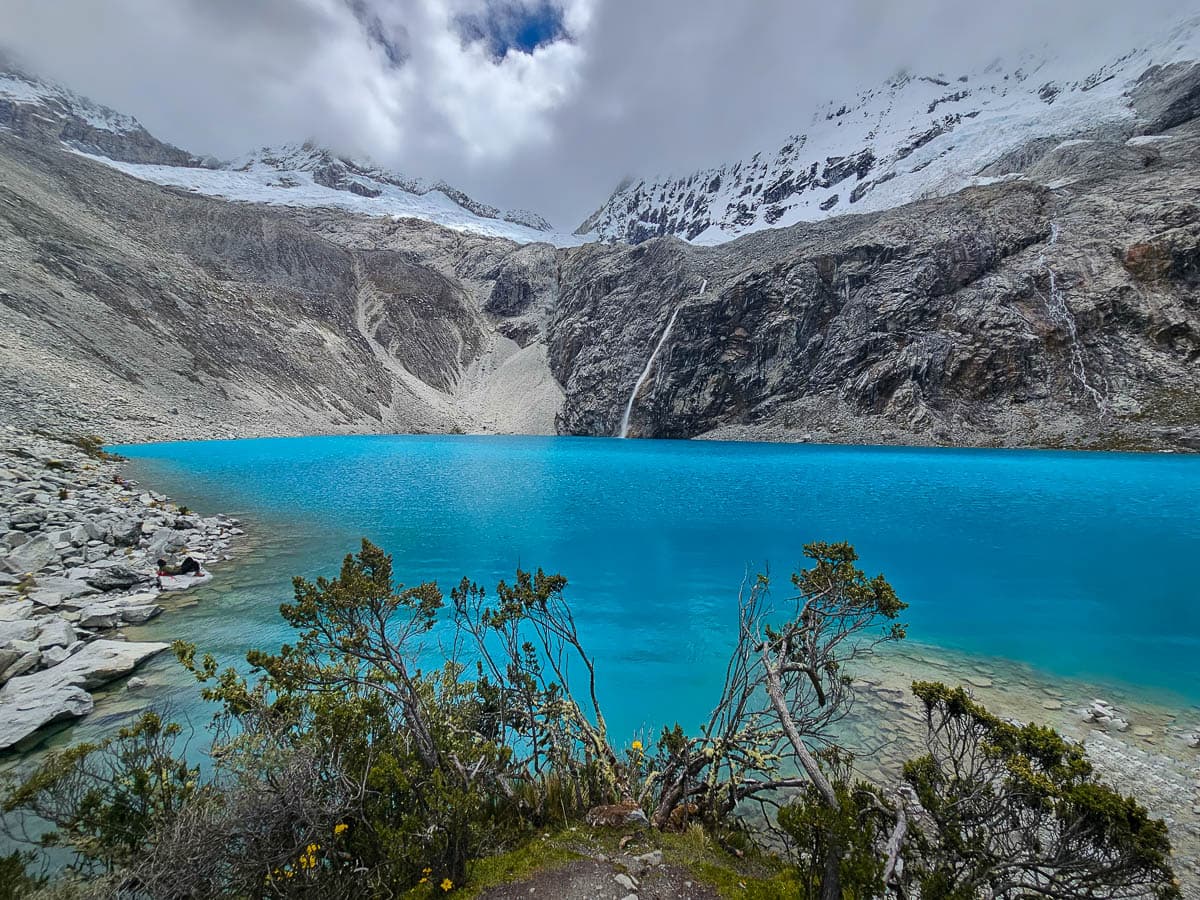
Finally, around 4 miles (6.4 km) in, the trail will once again flatten out and you’ll cross a rocky pathway to the shores of Laguna 69. The lake is nothing short of spectacular, with vibrant turquoise water that’s surrounded by the snow-capped Cerro Chacraraju.
Be sure to wander around the shores a bit—-the area by the lakeshore where the trail ends tends to get super crowded with hikers, but there’s plenty of space to spread out towards the western side of the lake.
For the return hike, you’ll simply retrace your steps back to the trailhead. Be sure to give yourself plenty of time—while the hike back down is easier, it took us longer than anticipated, due to the steep and rocky terrain.
Why is it called Laguna 69?
Laguna 69 is a stunning lake, but its name may make a few people with dirty minds giggle—so what’s with the name?
The story itself isn’t actually all that interesting. When Huascarán National Park was founded in the 1970s, officials inventoried the lakes and simply identified the unnamed lakes sequentially. Laguna 69 was simply the 69th lake they cataloged.
While the origin of its name may be a bit boring, it’s since become one of the most famous lakes in all of Peru!
When to hike the Laguna 69 trek
The best time to hike the Laguna 69 trail is from May through early October, when you have the best chance of dry skies and unobstructed views of the mountains. This also happens to be the busiest time to visit Huascarán, though, so be prepared to share the trail with other hikers.
The rainy season runs from late October through April. We visited in late April, assuming that the rainy season would be over by then. However, it rained every day for the entire week we were in Huaraz, so, if you visit during this timeframe, come prepared with a rain jacket (I have this one and Justin uses this one) and a sense of adventure!
The rainiest timeframe is January and February (they actually close the Inca Trail in February, because of the heavy rainfall!), so, if you can, I’d recommend avoiding visiting Peru during this timeframe.
Is camping permitted along the Laguna 69 hike?
No, camping is generally not permitted in Huascarán National Park, although there are some multiday hikes, like the popular Santa Cruz trek, that have designated campsites within the park.
Pssst... if you want to camp near a stunning lake, I'd suggest adding either the shorter Humantay Lake hike or the multi-day Salkantay Trek near Cusco to your bucketlist. Both of these hikes stop at Humantay Lake, with jaw-dropping turquoise waters and a massive snow-capped mountain towering above it, with lots of cool glamping options nearby.
Tips for hiking the Laguna 69 trail
Acclimate in Huaraz for a few days ahead of time
The Laguna 69 trail isn’t technically challenging, but it’s seriously no joke, largely because of the altitude it’s at.
The trailhead starts at almost 13,000 feet (396 m) over sea level and you climb almost 3,000 feet (914 m) higher than that. That’s REALLY high—for context, you can develop altitude sickness from being at just 8,200 feet (2,500 m) over sea level, which is obviously significantly lower than the elevations that you’ll be hiking to.
Accordingly, it’s REALLY important to include a day or two in Huaraz, which sits at 10,000 feet (3,048 m) of elevation, into your Peru itinerary to acclimate before tackling the Laguna 69 hike. Otherwise, you’re putting yourself at risk of not being able to finish the trek or much, much worse—people can die from altitude sickness!
Also, learn from our mistakes! Laguna 69 was the highest we’d ever hiked, so Justin and I were quite pleased with ourselves that we were able to make it up to the lake without issue—so proud of ourselves, in fact, that we celebrated by buying a beer from a park vendor at the trailhead.
As soon as either of us took a drink from our can of beer, we both developed horrible, head-throbbing headaches, presumably as a side effect from being dehydrated at high altitudes.
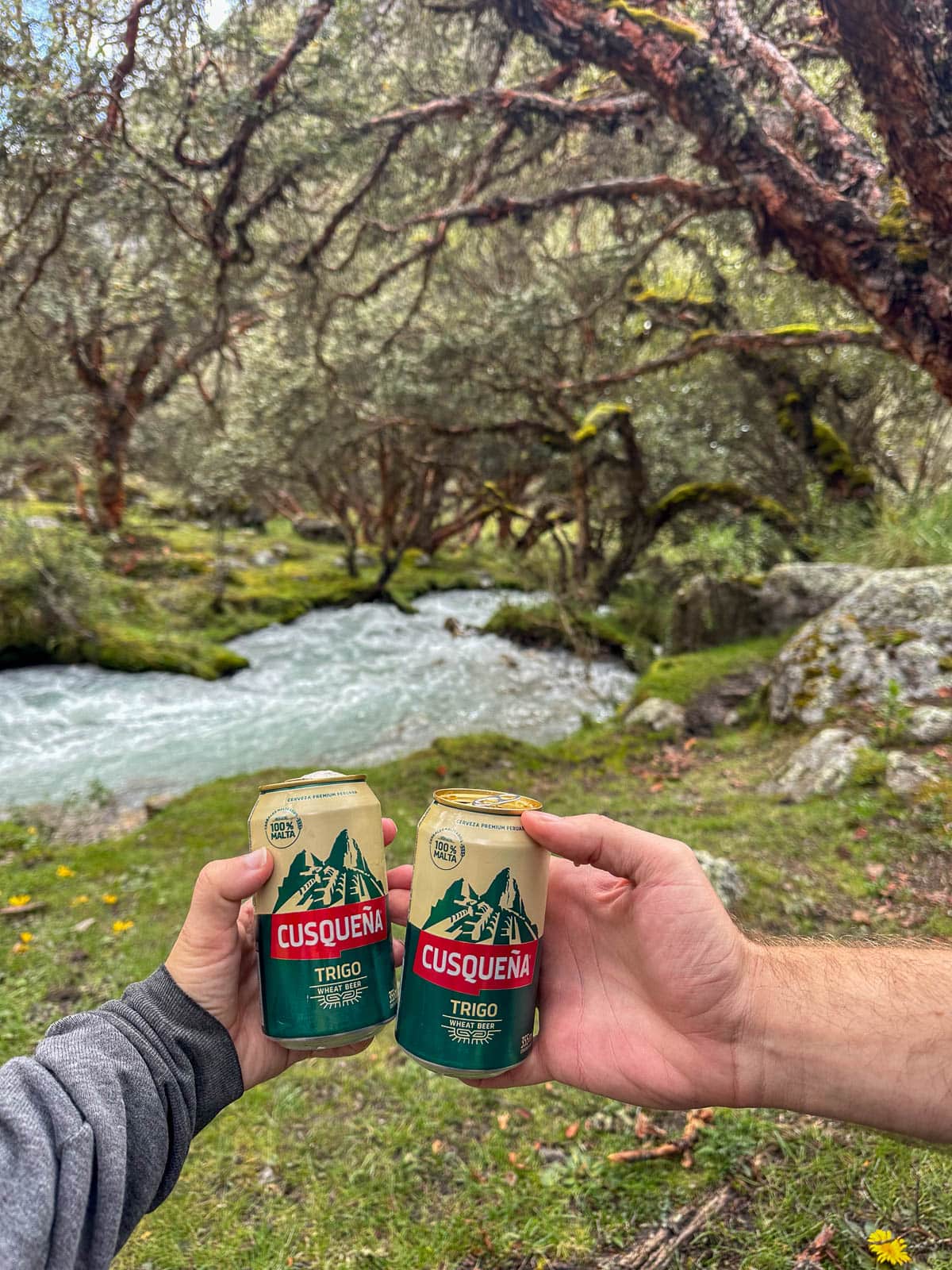
So bring plenty of water, stay well-hydrated, and keep away from that trailhead beer!
Bring a lunch
Most tours include a quick stop to buy breakfast at a restaurant and do not include any kind of lunch, snacks, or drinks. There’s a small stand at the trailhead that usually sells drinks, but otherwise, there aren’t any places near the trailhead for you to purchase any kind of food.
The Laguna 69 hike is a loooong day. We were actually on our tour for close to 15 hours. So be sure to bring something along with something to snack on—keeping yourself well-fed is important to stave off altitude sickness as well.
What to bring on the Laguna 69 hike
- Peruvian soles: For your national park entry, breakfast, and any drinks or snacks you want to buy
- Refillable water bottle
- Trekking poles: There’s some steep and rocky sections along the hike, so your knees will thank you!
- Advil
- Lunch
- Rainjackets (his | hers)
- Warm layers: The weather is unpredictable at higher elevations and it can get surprisingly cold at higher elevations. So I’d recommend wearing lots of layers that can accommodate you as you’re sweating your buns off while you’re climbing up to Laguna 69, but will keep you warm if you get caught in a snowstorm or freezing rain.
There you have it—everything you need to know about the Laguna 69 hike. Do you have any questions about this trek? Let us know in the comments below!
